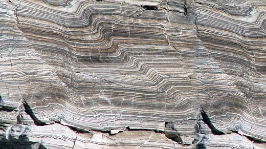
Convergent boundary
A zone where lithospheric plates collide and subduct.
When two or more of Earth’s lithospheric plates crash into each other, the area is called a convergent boundary (sometimes referred to as a destructive boundary). In these collisions, one plate is eventually forced beneath the other—a process known as subduction. The subduction zone itself is defined by a plane where earthquakes are common, called the Wadati–Benioff zone. These plate collisions take place over timescales of millions to tens of millions of years, and they can trigger volcanic activity, earthquakes, mountain building, the destruction of lithosphere, and deformation of the crust. Convergent boundaries happen between oceanic and oceanic lithosphere, oceanic and continental lithosphere, or continental and continental lithosphere. The specific geologic features that appear depend on the types of crust involved.
The engine behind plate tectonics is convection currents in the mantle. These convection cells form because heat from the radioactive decay of elements inside the mantle rises toward the surface, while cooler material from the surface sinks back down. At spreading centers, hot mantle material rises to the surface and creates new crust. As this fresh crust gets pushed away from the spreading center by even newer crust forming behind it, it cools, thins, and becomes denser. Subduction starts when this dense crust meets a less dense crust. Gravity then helps pull the subducting slab down into the mantle. As the relatively cool slab sinks deeper, it heats up, causing hydrous minerals inside it to break down. This releases water into the hotter asthenosphere, which triggers partial melting there and leads to volcanism. Both the dehydration and partial melting happen along the 1,000 °C (1,830 °F) isotherm, typically at depths between 65 and 130 km (40 to 81 mi).
Some lithospheric plates are made up of both continental and oceanic lithosphere. In certain cases, when two plates first converge, the oceanic lithosphere gets destroyed, eventually bringing two continental plates together. Neither continental plate will subduct. It’s likely that the plate may break along the boundary between continental and oceanic crust. Seismic tomography has revealed pieces of lithosphere that have broken off during these collisions.
**Subduction zones**
Subduction zones are places where one lithospheric plate slides beneath another at a convergent boundary becau
- type
- Geological feature
- process
- Subduction
- depth_range
- 65 to 130 km (40 to 81 mi) for partial melting
- earthquake_depth
- Up to 670 km (416 mi)
- trench_width
- 50 to 100 km (31 to 62 mi)
- plate_types
- Oceanic-oceanic, oceanic-continental, continental-continental
Lore & Background
Convergent boundaries are driven by convection currents in the mantle, which result from heat generated by radioactive decay of elements. These currents bring hot mantle material to the surface at spreading centers, creating new crust that cools, thins, and becomes denser. Subduction begins when this dense crust converges with less dense crust, with gravity helping to pull the subducting slab into the mantle. As the slab sinks, hydrous minerals break down, releasing water into the asthenosphere and causing partial melting and volcanism along the 1,000 °C isotherm.
Reader's Guide
Convergent boundaries are significant because they are the primary sites of subduction, which drives plate tectonics and shapes Earth's surface through volcanism, earthquakes, and mountain building. They produce volcanic arcs, such as island arcs and continental arcs, and are associated with oceanic trenches, the deepest parts of the ocean. The release of water from subducting slabs leads to partial melting and magma generation, though these processes are not entirely understood. Convergent boundaries also generate megathrust earthquakes that can cause tsunamis, as seen in the 2004 Indian Ocean and 2011 Japan events. The study of these boundaries, including seismic tomography, has revealed detached slabs and torn plates, providing insight into deep Earth processes.
Did You Know?
- The Wadati–Benioff zone, a plane of earthquakes, marks the subducting plate at convergent boundaries.
- Oceanic trenches average 50 to 100 km wide and can be several thousand kilometers long.
- The Mariana Trench, at approximately 11,000 m deep, is the deepest point of the ocean.
- Back-arc basins form behind volcanic arcs and often contain seafloor spreading centers.
More in Structural Geology And Tectonics 1-24
Spotted an error? Know more?
This is a living reference — every entry is fact-audited, and reader corrections feed straight into our audit queue. Suggest an edit · See this site's audit record